Fonds & collections
Votre recherche a retourné 72 résultat(s)
-
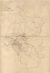
Carte de la commune de Carmaux : périmètres de l’octroi
Carte de la commune de Carmaux : périmètres de l’octroi
-
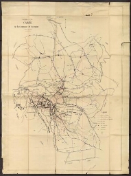
Carte de la commune de Carmaux : périmètres de l’octroi et réseaux électriques
Carte de la commune de Carmaux : périmètres de l’octroi et réseaux électriques
-
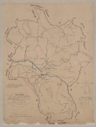
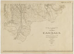
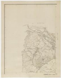
Carte générale des chemins de la commune de Carmaux
Carte générale des chemins de la commune de Carmaux
-
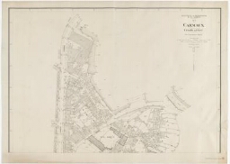
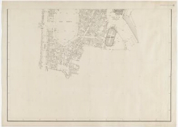
M.R.L. CARMAUX. Plan topographique régulier au 1/500._ Secteur limité à l'Ouest par l'avenue Albert-Thomas, incluse._Plan partiel, feuille 1
M.R.L. CARMAUX. Plan topographique régulier au 1/500._ Secteur limité à l'Ouest par l'avenue Albert-Thomas, incluse._Plan partiel, feuille 1
-
M.R.L. CARMAUX. Plan topographique régulier au 1/500._ Secteur limité à l'Ouest par l'avenue Albert-Thomas, incluse.Plan partiel_ feuille 2
M.R.L. CARMAUX. Plan topographique régulier au 1/500._ Secteur limité à l'Ouest par l'avenue Albert-Thomas, incluse.Plan partiel_ feuille 2
-
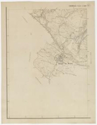
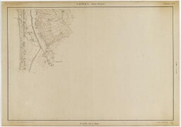
M.R.U. CARMAUX._ Plan topographique expédié au 1/5000. _Zone sud-est, feuille 4.
M.R.U. CARMAUX._ Plan topographique expédié au 1/5000. _Zone sud-est, feuille 4.
-
M.R.U. CARMAUX._ Plan topographique expédié au 1/5000. Zone sud-ouest, feuille 3
M.R.U. CARMAUX._ Plan topographique expédié au 1/5000. Zone sud-ouest, feuille 3
-
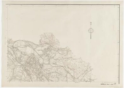
M.R.U. CARMAUX._ Plan topographique expédié au 1/5000._Zone nord-est, feuille 2
M.R.U. CARMAUX._ Plan topographique expédié au 1/5000._Zone nord-est, feuille 2
-
M.R.U. CARMAUX._ Plan topographique expédié au 1/5000._Zone nord-ouest_feuille 1
M.R.U. CARMAUX._ Plan topographique expédié au 1/5000._Zone nord-ouest_feuille 1
-
M.R.U. CARMAUX._ Plan topographique régulier de la ville de Carmaux au 1/2000 (rattaché à la triangulation des mines de Carmaux)._Bois Redon, feuille 5
M.R.U. CARMAUX._ Plan topographique régulier de la ville de Carmaux au 1/2000 (rattaché à la triangulation des mines de Carmaux)._Bois Redon, feuille 5